Sunday, June 26, 2011

Day Three

I woke up on the brink of insanity – a mosquito was flying around my head and buzz buzz buzzing.  After several attempts to hide from it by pulling the blankets over my head I got up and escaped to the bathroom.  The damage was impressive – my back had been feasted on overnight and my arms were as hilly as the mountains around us.  Wendy and Catherine didn’t fare much better – we had dead bloody mosquitoes our beds.  We battled the remaining mosquito army in the room for a while and then quickly got ready and packed up.  We had a yummy breakfast in the lodge and then got the heck out of there – probably with a cloud of mosquitoes trailing behind us!  Today’s road plan was the remaining 295 miles of the Cassiar Highway and then 270 miles to Takhini Hot Springs, just outside of Whitehorse.  We hoped to get to our camp with enough time to soak in the hot spring pool.  The Cassiar Highway was still a wealth of wildlife – we saw another 7 bears, including another mama and her babies.  I learned a Sarah Palin lesson first-hand: I thought it was odd that the babies high-tailed it for the woods while the mama just hung around while we were parked on the side of the road taking pictures.  Catherine said she was waiting to see what I was going to do – mama grizzlies protect their young!  We stopped at Jade City to look at the jewelry made from the plentiful jade mined from the surrounding areas.  The only buildings in Jade City seem to be those selling jade products…  We were about 50 miles from the Alaska Highway junction when we started seeing some burned out trees.  Pretty soon both sides of the highway had gone from evergreens to blackened toothpicks for as far as the eye could see, and every time we thought it was done, it started up again.  There was apparently a huge forest fire in that area last summer and possible a smaller one earlier this month.  You always hear the number of acres that have burned after a forest fire and it seems like a big number but until you drive for 40 miles through a destroyed forest, you really can’t imagine how big that actually is.  It was a bit depressing – but had we known at the time how big this actually was, we’d probably have taken some pictures.  We crossed into the Yukon Territory – a new Canadian province for me! – and got on to the Alaskan Highway – FINALLY!!  All along the highway people have spelled out messages in rocks, like their names, sports teams, etc.  I wanted to spell out either my name or Bells of the Sound, but we agreed that we didn’t have time to collect all the rocks needed.  Once again I get skunked for having a long name – it’s just like when I had to take a standardized test and could only be “Jennif”.  The weather again was beautiful but we saw a dark cloud and lightning off in the distance.  Soon we were driving through an intense thunder storm.  On the plus side, it wiped some of the bugs off the windshield! We were soon at Whitehorse and made our way to Takhini Hot Springs, but not before we stopped for gas and ice and witnessed a beer-purchasing scene similar to the one we saw in Juneau *last* time we were here!  I read in the Milepost that Takhini means “mosquito river” – after last night’s battle, I was no longer that excited about camping here!  We got the camp set up and dinner on the fire – apricot glazed chicken packets and grilled potatoes and veggies – and then experimented with baking crescent rolls on a stick in the fire.  Let’s just say there is a fine art to this, and while we may not have mastered it, it sure was yummy trying!  After dinner we went into the hot spring-fed pool.  It was warm and so relaxing after days of being stuck in a car.  Back in camp, we cranked up the fire again for a s’mores pajama party, but in the time we were at the hot springs, the mosquitoes moved in.  The fire didn’t really deter them at all and we adjourned to the netted safety of our tents.  It was just after 11 PM, and I could read a book in my tent without a flashlight.  Seriously – how do people sleep up here?????

Pictures - Sunday, June 26

That's what you get for trying to bite Catherine in the shower!

Carnage in bed

More bed carnage - darn mosquitoes!

We found a bear!

We honked the car horn and he looked.

Traffic stop on the Cassiar

Dease Lake on the Cassiar

I love the handwritten note with advice!

Cassiar Mountains

Another bear!

Jade City

Entering the Yukon Territory!

The Canadian Continental Divide

Nisutlin Bay Bridge, entering Teslin

Dinner! Apricot-glazed chicken and grilled potatoes and vegetables

Grilled crescent rolls

After the hot springs - trying to avoid the mosquitoes

View from my tent at 11:50 PM

View in my tent at 11:50 PM - with no flash

Saturday, June 25, 2011

Day Two

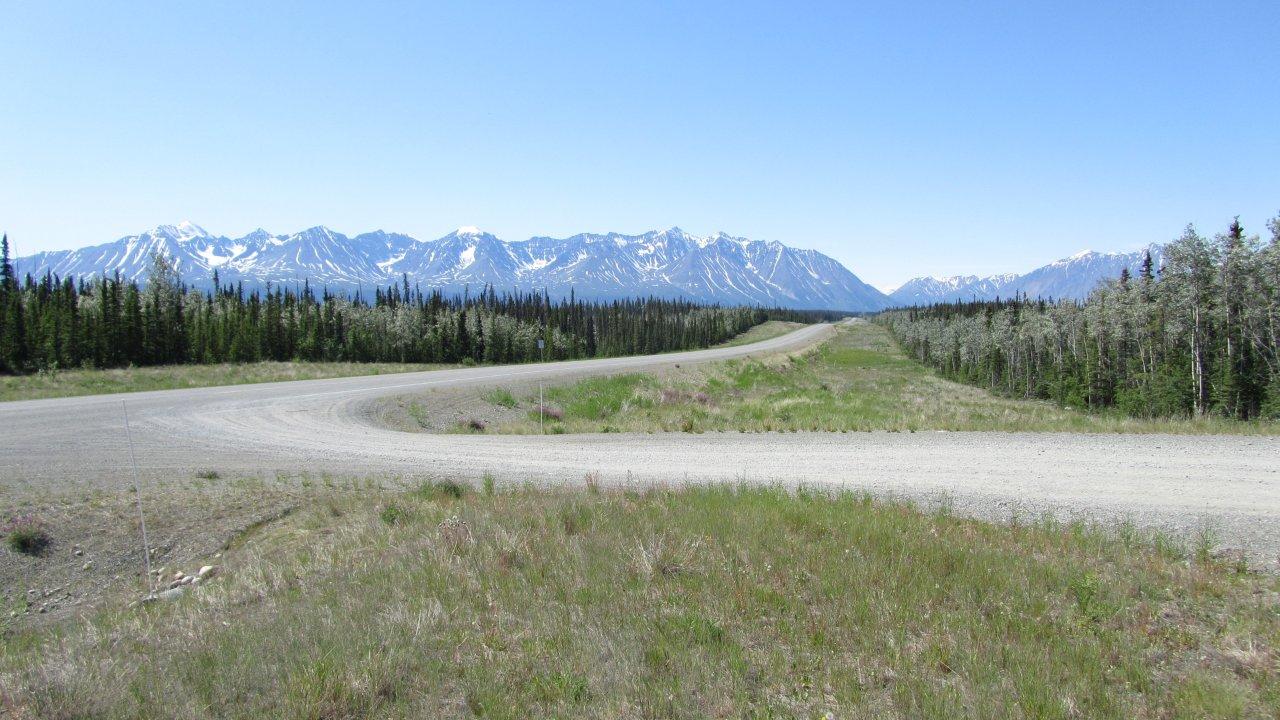
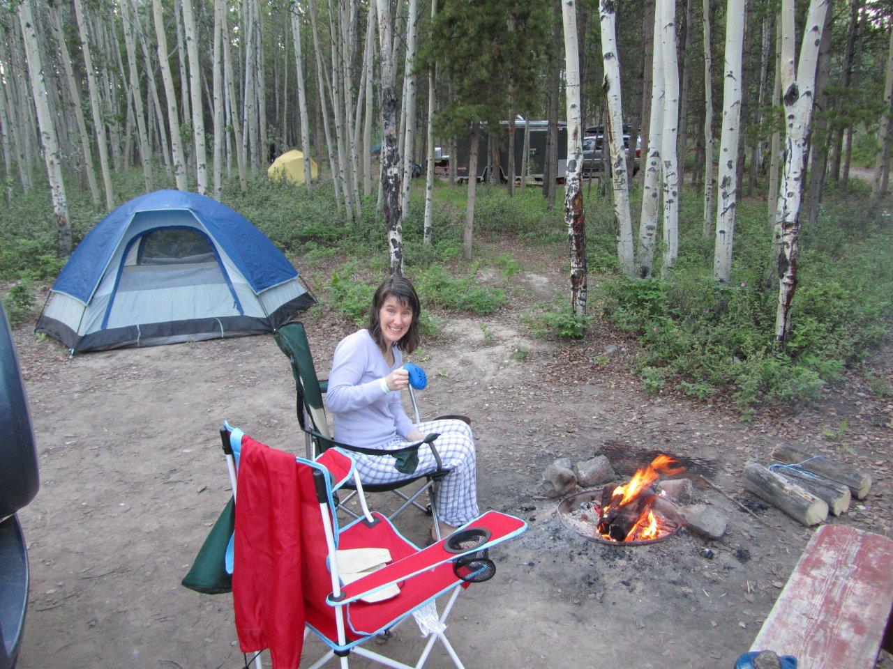
I woke up at 4:30 AM, thanks to the early rising sun.  I rolled over and tried to go back to sleep, but when I heard Catherine attempting to make a fire around 6 AM, I got up, too.  (The rule was whoever got up first had to start the campfire.)  We managed to make a breakfast feast of sausage, eggs and oatmeal and get most everything packed between the raindrops and then headed to the shower. It was a pay shower – a Loonie for “10-ish minutes”, per the sign on the wall.  I think it was closer to 8-ish minutes, and was grateful I had another Loonie on hand! This was a big travel day – we were traveling on the West Access Route from Lac La Hache to Prince George (188 miles), then west on the Yellowhead Highway to Gitwangak (298 miles), and finally north on the Cassiar Highway to Bell 2 Lodge (155 miles) – at total of 641 miles.  And we were hoping it would be a big wildlife day – after all, I was promised sightings of bear and moose!  The Milepost had a listing for Cariboo Wood Shop, which specializes in fresh fudge and lattes, which sounded like a delightful combination after being on the road for a whole hour!  We knew we weren’t in Seattle anymore when the clerk asked us if we were in a hurry because she wasn’t very fast at making lattes. But all was good after several fudge samples – we walked out properly caffeinated and sugarated!  Back on the road we drove through Quesnel and caught site of the “World’s Largest Gold Pan”.  We didn’t get tricked into stopping for this “World’s *-est” thing – but did take a fly by picture! At Prince George we turned left onto the Yellowhead Highway.  Signs on the highway promised pie and ice cream at J & S Drive In in Vanderhoof, so we stopped there.  I was intrigued by the wareneki on the menu and had to try it.  The restaurant specialized in Mennonite food and while the cottage cheese stuffed perogies smothered in a white gravy with a piece of grilled sausage on the side was one of the oddest lunches I’ve had in a long time, it was delicious! We sampled the cherry and coconut cream pie for dessert - yum!  As we sped on towards the Cassiar turn off, we spotted our first bear – just hanging our near the side of the road eating in the bushes.  This was getting exciting!  Unfortunately, bears tend to run away when they see a car on the highway stop abruptly, put it in reverse and head towards them so we couldn’t get many pictures of them.  Finally we reached Gitwangak and turned north onto the Cassiar Highway.  The terrain started changing from the flatter farmland and got more hilly and mountainy.  The Cassiar is not a busy highway and has very few services on it.  However, it makes up for all that in bear.  We spotted 11 more bear before we got to Bell 2 Lodge, including a mama and her 2 cubs.  We finally pulled in to Bell 2 Lodge, which is primarily a place for heliskiers in the winter, around 9 PM.  As we carried our stuff up into our comfy alpine-inspired room, we had to dodge the swarms of mosquitos outside.  We were very glad to have a bed inside and away from them that night…

Pictures - Saturday, June 25

Cariboo Mountains

Cariboo Mountains

World's Largest Gold Pan in Quesnell

Bear!


Bell 2 Lodge

Bell 2 Lodge

Our cabin - upper right

Bell 2 Lodge

Bell 2 Lodge

Sauna at Bell 2 Lodge